22th July – 6th August 2016
Introducing Iceland
Iceland is known as the ice and fire land. And so it is. Everywhere you go you’ll find volcanos fumes and fumaroles, tongues of glaciers, drifting icebergs in lagoons or towering cliffs inhabited by puffins. Definitely, landscapes that will make you speechless.
We are very adventurous and nature lovers, and for us this place is one of the most thrilling destinations.
Iceland is at the Northeast end of Europe, it has a little more than 300 000 inhabitants and an area of about 100 000 km². Iceland is placed at the mid-Atlantic ridge, so it’s a country with a high volcanic and geological activity, and this can be observed with the naked eye in its landscape. The inlands are on a plateau with deserts, mountains, glaciers and glacier rivers flowing towards the sea. It’s said that thanks to the Gulf Stream, the weather is mild compared with its latitude and this provides a habitable environment… With this I understand that they refer in winter it’s usually not under -5º.
The official language is the Icelandic, impossible to understand. The good thing from the language is that it’s normally pronounced as it’s written. If you learn some suffixes or words it’ll be very helpful. For example, anything ending in -jökull means a glacier, in -vík it’s a bay, -nes designates the peninsulas, and -foss is for cascades. Knowing this, what does Reykjavík mean? Steaming bay!
In Iceland you’ll find multitude of cascades. There’s something for everybody and you won’t know which one you like the most for sure. Gullfoss (in the golden circle), Skógafoss, Svartifoss (with basalt columns), Seljalandsfoss you can cross it from behind), Godafoss (God’s cascade) y Dettifoss are the most famous. It’s true the first ten cascades will leave you speechless, but eventually the overcrowding will make you to show less interest than they have. My advice is to not visit all of them (you should for the ones in the list, but not all the ones you find on your way), or if not the greatest ones won’t be so spectacular after all.
Here you have the itinerary we followed during these two weeks:
I recommend you have a look to my post tips for your trip to Iceland. I didn’t want to make this post to long.
Day 1 ( Friday 22/07): flight departure with Primera Air. Alicante-> Reykjavik. Duration: about 4.5h
In Iceland the time zone doesn’t change, this is, summer and winter times are the same.
Bus is the cheapest way of transportation to go to the capital from the airport. There’s a line called Flybus that goes from the airport to the Reykjavik Central station. One go takes around 50 minutes and it costs 2200 ISK (16,21€). Nevertheless, if you want the buds to leave you at the door of your hotel, the ticket costs 2.800 ISK (20,64€). You should buy the tickets before entering the bus. Our return trip ticket cost 2800 ISK for each one. By the way, the departure times depend on the arrival of the international flights.
In Reykjavik we stayed in a highly recommended Airbnb apartment. Near the city center and clean (announcement 12317461). We bought some food in a close supermarket and relax.
Day 2 (Saturday 23/07): Free day in Reykjavik.
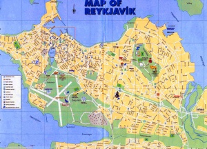
Reykjavik is one of the smallest European capitals, with a little more than 100.000 inhabitants (double if including the metropolitan area), so two out of the Icelandics live in that part of the country.
Reykjavik’s old town is tiny and elegant, without any buildings differing from its Nordic traditional architecture, except for the modern Lutheran Church (cathedral), Hallgrímskirkja, more than 74 meters high which design is inspired in basalt columns. We were lucky of attending an organ concert right there. You can go up the tower (paying previously) and observe the colorful city from the heights. Closed on Mondays. 9:00 – 20:00 h.
The lake Tjörnin is a good place to calmly walk around, same as on the small Port surroundings, they are the nicest city places. I should say it’s a small city for a perfect one day visit.
In Reykjavik there’s party almost every day. The Icelanders come from all over the country to see a bit of civilization. In the town’s heart, at the Laugavegur Street, the main street, you’ll see a bunch of bars offering all kinds of alcoholic beverages promotions (at prohibitory prices, of course).
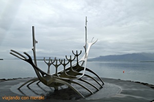
Another must see is the sculpture Sólfar (the solar boat) – 1987, which outline seems to represent both a Viking boat with all its moving oars and some kind of insect.
Finally, I recommend to walk around and enter the Reykjavik Harp building. It’s a concert and conferences hall. With a little of luck you’ll be able to attend to a concert or a theatre play during your stay. It’s placed in front of the sea and it has a very modern design.
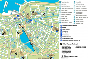
Day 3 (Sunday 24/07): Pick CAMPER VAN.
To pick the kuku camper, you need to take bus 1 until Háskóli Ísland stop (afterwards we realized they had shuttle service -not sure if for free- to reach their office). the price of the bus is 420 is (3.10€). you can only pay in cash (Exact change) or with the transpot card. You can also buy the ticket fit there bus online ( http://www.straeto.is/english/buy-tickets/) for more information about bus service in Reykjavik here you have the website: https://www.straeto.is/en/.
In order to go to kuku camper’s office you should stop in Hraunbrún stop, and from there walk to the offices.
We took some additional stuff like a power inverter (to recharge things although for instance the hair dryer didn’t work), a BBQ (with the bad weather we could only use it a couple of times) and a GP insurance (wider care insurance. Not all the roads are paved and the grave harm is covered only by this insurance).
Here it begins our Iceland road trip!!!
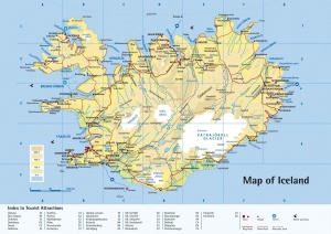
We started the tour through the Reykjanes peninsula, stopping by the blue lagoon to have a bath in its thermal waters.
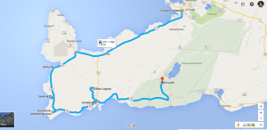
From Reykjavik you should take the same direction as the airport and in 45 km you should turn off towards Hafnir (fishing village). In the south there’s a gorge with many sea birds and from there usually you can see whales (we saw not even one). To arrive you should park in the middle of the road (you’ll see, there will be more parked cars) and walk towards the sea for around one hour.
We continued southwards crossing Sanvík (bridge between two continents Europe / America). Here is the separation of the tectonic plates.
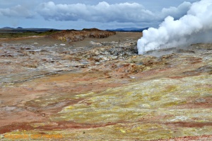
Arriving at the corner of the peninsula you find Gunnuhver, a zone with fumaroles and sulfur pools. The place is marked but you have to be careful not to pass the indication. Following the coast we arrived at the fishing village of Grindavík, with the diversion to the blue lagoon (9h-21h). It is one of the most famous baths in Europe: the Blue Lagoon. The spa is born on a lava field and it is outdoors. The water is turquoise blue (from the siliceous).
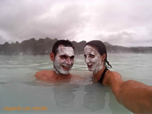
You get several options although the cheapest (50 € / person) already includes face masks. I recommend buying the tickets in advance (http://www.bluelagoon.com/blue-lagoon-spa/prices-and-packages/) because it is usually very crowded in summer and it sells out easily. It has very good facilities (it’s great to have a shower here and dry your hair if you travel in camper).
We left the Blue Lagoon, crossed Grindavik, a small fishing village and headed towards the Krýsuvík Geothermal Area. It is a zone of fumaroles, boiling lava pools and sulfur springs. There is a marked path to see the area walking (30 min), following a long wooden walkway and ending with an area (only suitable for intrepid) with the terrain a bit unstable (muddy) to which you can climb and admire the views from above. In this area we spent the first night, because in the Krýsuvík parking there is even a public restroom. Sleeping listening to the pools and waking up with those views is priceless.

Day 4 (Monday 25/07): Golden Triangle
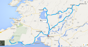
We hit the lonely road 427 that borders the south of the Reykjanes peninsula, watching film-like landscapes with lava fields and sometimes we found some green parts (moss). On the way we passed by Þorlákshöfn (Thorlákshöfn), a fishing village and currently a ferry port to the Westman islands. We went through Hveragerdi and at 12km we took the road 35 to the junction with road 36, which we took to Thingvellir, the first element of the golden triangle.
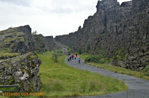
Thingvellir, Þingvellir in Icelandic, is the National Park where we will find the crack that separates the two tectonic plates and that has sunk the valley that is just in front of it. You can take a walk through the crack or look at the waterfall Öxarárfoss. Thinvellir is the most visited in the country and it’ll be full of people, but it is worth it because of the spectacular scenery.
In the national park we visited Almannagjá: it is a large fissure of the rock, part of the fault system, 7 km long, which indicates the line according to which the area has sunk.
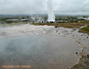
We continued the road towards Geysir, the second corner of the circle / golden triangle (roads 365 + 37). Geysir gave name to a great natural phenomenon. The word geyser comes from the great Icelandic Geysir, which before ceasing to erupt (because of humans throwing stones on it) spat its stream at 80 meters. Today you can visit the old and dormant geyser or see the Strokkur, next to it, that every ten minutes or so throws a stream of hot water exceeding 20 meters in height.
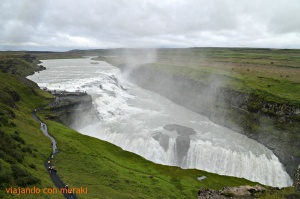
We continued along the road 35 northeasterly to the last element of the golden circle: Gullfoss (the golden waterfall), the most spectacular waterfall in Europe. It is created by the river Hvítá which has 3 jumps of 11, 21 and 32 meters respectively, in a sharp curve that ends in a crack where the fluvial course seems to disappear by magic. In this waterfall there are two signposted paths: a top path that allows you to see with perspective the triple waterfall and another that borders the bottom and in which you will end up a little wet.
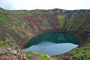
We returned on the road 35 southwards, and 4 km before the junction with road 36 we found the crater of Kerid, almost 200 m in diameter and 50 m deep, and whose walls are lava and red ash. From its summit there is a beautiful panorama. Overnight camping at Selfoss, which is quite nice.
Night at Selfoss Campsite, quite nice.
Day 5 (Tuesday 26/07): Landmannalaugar trip.
We bought the bus tickets in advance to go from the Selfoss campsite to the Landamaugar base camp: 7.30am-> 10am. The return schedule can be changed on the fly. (Https://www.re.is/iceland-on-your-own/)
Landmannalaugar is a popular destination among tourists, especially recommended for people who like walking and hiking. It is a small region of the Fjallabak Natural Park, which is a large reserve covering about 47,000 hectares of the inhospitable uplands of the interior of Iceland. It is an area sculpted by the intense volcanic activity of the area, full of lava fields and mountains of many different colors, filled with valleys, rivers and lakes.
The typical thing here is to make the “Laugavegurinn” route, considered as one of the most beautiful footpaths in the world. Known internationally and located in the enclave of four glaciers, it is a route of 55 km that is usually realized in 3 stages (3 days) sleeping in the shelters (or tents). In general it is not a complicated route, it is signposted all the way and the terrain is quite comfortable. It is recommended to book in advance for a year in these refuges (Landmannalaugar, Landmannahellir and Hrafntinnusker) as the capacity is very limited and the demand is very high (it costs 7 € / night for camping, 30 € for shelter) The route data is as follows:
– Coordinates: N63 59,436 W19 03,681
-Difficulty: Medium
-Distance: 67km. Possibly if we do not opt for extra routes it is less than 55km.
-Overall total: 1300m
-Discount total: 1300m
-Last Attitude: 1065m
In the case of Landmannalaugar it is recommended to hire an excursion in the event that:
A) The road is closed from June to September.
B) Do not have a 4 × 4 vehicle (it is forbidden to drive by Landmannalaugar without 4 × 4).
C) Do not have experience driving on gravel roads and safety at the crossing of rivers.
D) Trips in Autocaravana or Camper.
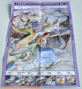
Once in the base camp there is an information office where you can buy a map of the area and see the different routes possible. There are short day trips ranging from 1.5h to 7h.
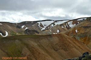
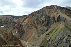
We made the red route that leaves from the base camp, which coincides with part of the first stage of Laugavegurinn. Then we took the yellow route that goes to the right and we returned to the base camp taking the white route. In total it took about 4 hours calmly and stopping to take photos.
What should we take to the Landmannalaugar?
- Warm clothes as if we were in winter.
- Waterproof and / or windbreaker in jacket and pants.
- Gloves and cap.
- Thermal underwear.
- A pair of socks in case they get wet
- Backpack
- Map / GPS.
- Food and water (Water can be taken from the river as long as it is not hot)
- Cream and sunglasses
- Swimsuit
We returned to the base camp and only one of us, David, was brave enough to take a bath in a pool of hot water (full of tourists, of course).
Return to Selfoss. Night at the campsite.
Day 6 (Wednesday 27/07):
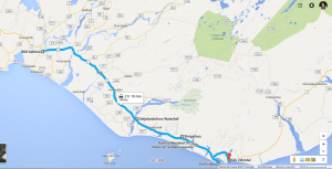
Departure to the south coast. Day trip on the south coast, visiting the waterfalls of Seljalandsfoss and Skógafoss and the great promontory of Dyrhólaey, where large colonies of seabirds live, among them the famous “Puffin”. We took the Ring road southwards to Seljalandsfoss waterfall (60m). It is one of the best waterfalls placed on what was once a cliff. The Seljalandsá River falls for 60 meters. What differentiates this cascade from the others is that it allows you to surround it from behind. There is a well defined path (be careful with mud and do not slip).
Walking 10 minutes along the trail that leads from the Seljalandsfoss camping site, there is another waterfall hidden behind the rocks called Glúfrafoss and in which you will end up wet to see it.
Note of INTEREST: Just 10 km before arriving at Skógafoss coming from the Ring Road from Seljalandfoss there is a typical stop for a few years. There is a visitor center that tells what happened with the eruption in the spring of 2010 of the Eyjafjallajökull volcano, which paralyzed the air space of more than half Europe for days. It is owned by the Þorvaldseyri farm, which was one of the most affected by the volcano, just above it. For 5 € you can see a documentary film with what happened, but what is most striking are the panels that are outside along the road where you see images of the eruption right there. We did not pay to enter but we stopped to see where the volcano and the pictures of the panels are.
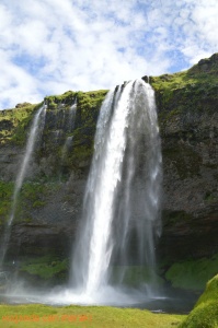
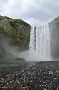
SkógafossContinuing along the main road we arrived at the town of Skógar (220 hab.). To the west of this locality you can find the Skógafoss waterfall. It is 20 meters wide and 60 meters frothy. This waterfall, which is 30 km past Seljalandsfoss, has at its top the beginning of the path of Fimmvörðuháls, which connects with the base camp of Landmannalaugar. This is the end of Laugavegurinn. The road crosses the pass that separates the glaciers of Eyjafjallajökull (to the west) of the Myrdálsjökull (to the east) following the route of the river Skógá.
Just to the right of the waterfall there are some wooden stairs to climb to the top of the waterfall. From here we did part of the Fimmvörðuháls road for about an hour and then we came back. It is well signposted, easy to follow and no loss possible. The scenery is brutal.
If you travel with a camper van or a caravan, you have the option of sleeping at the foot of Skógafoss, as there is a camping right here. Few times in your life you will wake up with such a landscape.
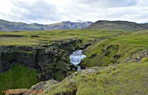
The next possible deviation from the Highway 1 is a short track to the left leading to the front of Sólheimajökull, a glacier tongue blackened by the amount of debris that has been mixed with the ice during its slow progress from the Myrdalsjökull towards the sea. We did not find it so spectacular compared to what we would see later, so if you’re don’t have much time, you can skip this one.
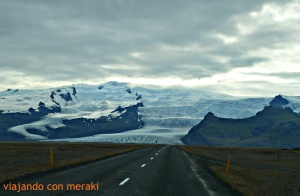
The views at this height of the Ring Road leave you with your mouth open. To the right the ocean and to the left a glacier. It is the Mýrdalsjökull glacier and blocks several volcanic cones, among them the dreaded Katla. Today you can trek through its ice and / or snowmobile route. Currently there is only one company that offers it (Arcanum). We did not do it.
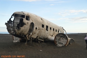
Following the road you will see a point where there are many cars parked. Here it begins a dirt road of about 4 km (warning: it takes longer than it seems) that leads to the coast to see a photogenic aircraft abandoned the US Navy in 1973.
In 1973, in the midst of the Cold War, when US troops still had an important base in Iceland, there was a forced landing on a black beach not many miles from Vík of a United States Navy Douglas Super DC-3 in which there was no Victims. But the device was left there forever and has given to many images that have been circulating for many years online. One of the challenges of many travelers is to find and photograph it, but their situation is not signposted on the road. The GPS coordinates of the exact situation of the airplane are: 63.459523, -19.364618 and those of the land access to the road are 63.4912391, -19.3632810.
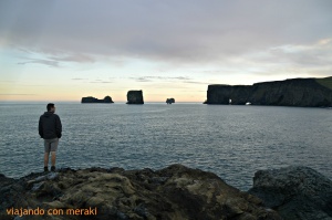
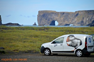
About 12 km before reaching Vík there is a road sign that informs us that Dyrhólaey is nearby (about 4 km). This lighthouse stands on a basaltic cliff of 110 m in height and is famous for a large stone arch of very photogenic volcanic origin. It is a Cape that merges with the sea and from which there are magnificent views of the black beach of Vík, the cliffs and even the snowy Mýrdalsjökull glacier.
Furthermore, these cliffs are a must stop for lovers of seabirds and, above all, puffins (or flying clowns). They can be observed from the end of April until the end of August. It is one of the best places in Iceland to photograph them close.
The road to Dyrhólaey closes between May 1 and June 25 not to disturb the birds in the process of breeding. At this time the puffins lay their eggs in the nests dug in the grass.
We spent this night in an idyllic spot, near the beach of Reynisfjara, with basalt columns. In the parking lot it is forbidden to camp, but next to it there is a dirt road is fine. Previously we had a shower at Vík campsite. In campgrounds you can pay just to use the shower.
Note: Vík camping has no hot water. It is from the few areas that the hot thermal water does not reach and they have to warm it up with thermos, and it’s not enough for all the camping customers.
Day 7 (Thursday 28/07):
In the morning, taking advantage of the sunrise on a site so spectacular, we took a stroll along the black sand beach of Reynisfjara and see the puffins there.
Shortly after leaving Vík we entered the Ring Road in a landscape provoked by the eruption in 1783 of the volcanic system Laki (composed by several volcanoes) that lasted more than 8 months and they were direct and indirect cause of more than six million dead .
In the middle of the road there is a stop from which you can observe the tongue of the glacier and its cracks. The views are very nice.
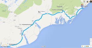
At the end of this landscape you will arrive at Skaftafell National Park, at the foot of the largest glacier in Europe, the Vatnajökull. This park has a visitor center, a large parking lot and a camping site. From the visitors’ center part an easy 40-minute route to visit Svartifoss, “the black waterfall” formed by columns of black basalt. (As I said before, after seeing so many waterfalls this did not seem to be the best either). From here you can reach the viewpoint of Sjórnarsker, all well signposted, from where you can enjoy magnificent views of the surroundings and the glacier.
Just two minutes after leaving the visitor center of Skaftafell (Ring Road east direction) we came across a white sign that says Svínafellskökull. It is one of the glacier tongued that we will be able to see more closely. It’s where we did trekking the next day. Read on to learn more 😉.
After the visit of the park, we continued to the Jökulsárlón lagoon, the lagoon of icebergs. On the way here it will be difficult for you to keep your eyes on the road, as the landscapes of the glacier tongues falling through the mountains will catch you.
Before arriving at the lagoon, you will see another road sign for Fjallsárlón. This is another glacial lagoon with similar landscape to which less tourists go. Of course it is smaller than the first and the glacier is closer. When we were there they were doing works and it looked like they were going to start exploiting it more tourist. Ah! And be prepared because the wind here blows wonderfully.
Finally we arrived at the Jökulsárlón glacier lagoon. At that moment it had about 18 km² of surface and 200 meters of maximum depth. It is filled with blocks of ice and icebergs that sail slowly to get lost in the sea. We met some curious seals playing in the lagoon. It is also worth seeing the area where the lagoon is “empty” and how the blocks of ice come sailing to the sea.
In the lagoon there is the possibility of hiring a boat trip. We did not do it. It was enough from the shore as the scenery is shattering.
It is recommended to watch it in the morning and in the afternoon, to see how the sunset paints red blocks of ice (this will only serve you if it does not make a cloudy day, as was our case).
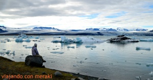
There are two parking, one located in the visitor center behind the bridge is where more than 90% of the vehicles are going to stop, since there the boat excursion is reserved (approx. € 25) and a less crowded one just before bridge.
We stepped back on our steps and spent the night at the campsite in Skaftafell National Park.
Day 8 (Friday 29/07):
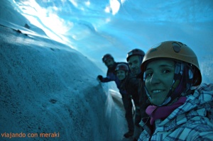
At 9am we had an excursion reservation: 4 hours walking on the Svínafellsjökull glacier with crampons. Wear warm clothing, raincoat, hat, gloves and hiking boots. We reserved it online in advance (http://www.mountainguides.is/day-tours/glacier-tours/from-skaftafell/glacier-adventure/).
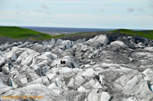
It was a totally recommendable experience. First we walked over the glacier tongue (you can see the first photo of the post) and then we entered one of the many tunnels inside. It’s amazing the colors, the sound … spectacular.
We finished the tour at around 1pm, ate in the visitor center a delicious lobster soup (in a walking stall, which was affordable and very tasty) and went on our way.
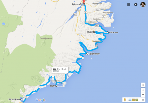
On Highway 1 you will still see glacier languages all the way. This stretch was a bit heavy because we took the car at 2:00 p.m. and did not arrive until 19:00. A few hours by car.
We passed Höfn on the way. Located in a marine lagoon, this fishing town is known for its lobster. We did not stop because we knew we still had some driving to the destination.
We continued towards Egilsstadir, crossing the eastern fjords between impressive cliffs and small fishing villages.
Road 1 borders the first of the fjords we saw, the Berufjörður, dominated by the massive pyramid of Búlastindur (1063m). It is a complicated section of driving along the narrow road and because there are unpaved stretches (yes, the country’s main road).
After Breidhdalsvik, we had two options:
-
- The option to take the road 96 + 92 with a much more difficult route, 60 km longer and 1 hour added to Egilsstadhir, entering the splendid landscapes of the eastern fjords of Iceland. If we take this option, after the fishing village of Búdhir (Fáksrúdhsfjördhur), leaving the Djupivogur, bordering the Berufjordur fjord, shortly after arriving at the bottom of the fjord, the detour appears to Eyjólfsstadir, after crossing the river and at the end of a waterfall is Fosárfoss waterfall crystal clear, one of the jewels of Iceland hidden in the nature. Then, past the Vattarnes lighthouse, you enter the fjord of Reydarfjördhur, the largest of the eastern fjords, surrounded by massifs over 1000m.
- The option to continue on the inside (if it is bad, it is the best option). In this way we will enter into the lonely and long valley of Breihdalsvík, equally elongated between two high and spectacular massifs. Once overtaking the steep Breidhalsheidhi port (470 m altitude and 12% gap), from where you can enjoy splendid views of the surrounding mountains and the small lake of Heidharvatn, you cross the difficult 939 mountain track which returns after 21 Km to Ring Road. Taking it for 1 km you reach the Öxara waterfall, with a waterfall of about 30 m and encased in a rock amphitheater (best seen from the left side of the river).
We chose option 2 because we wanted to get to the destination soon (we were already tired of so much car). I cannot tell you how the landscape of option 1 was but the one of this option is brutal. There is an ascent to a valley with magnificent views. Of course, there are sections where Highway 1 is not asphalted.
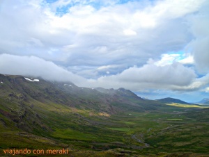
Arrival in Egilsstadir, industrial town. Night in the camping of the city.
Day 9 (Saturday 30/07):
In the morning we did some shopping in the supermarket of Egilsstadir and load provisions for a few days.
OPTION: Departing from Egilsstadir and direction to the port of Seydhisfjördhur via road 93, after 3 km there is an excellent panoramic view over Lake Lagarfljót. (We did not do this)
Leaving the East, you will reach the northern part, the Jökulsárgljüfur National Park, visiting the famous Dettifoss waterfall and the Gods Gorge, Asbyrgi.
After the bridge over the Lönakill, the Ring Road enters a mountainous area and dangerous by the wind blowing with sand accumulation. Then you come to the desert of Geitasandur, worth ash and pumice from the Askja volcano.
At km 94 you cross, after 2km, the Mödrudalsfjallgarduvestri, mountain range that closes to the west the Geitasandru, with slopes of 10%. From the summit you can enjoy a splendid panorama of the nearby mountains and desert areas.
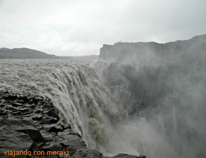
At the junction located 33 km west of Reykjálíd and 130 km east of Egilsstadir, it begins the gravel road 864. You will think you are in the wrong way because it is a dirt road very poorly conditioned and you will hardly see cars (you will notice it is not the same volume of tourists in the north as in the south of the island). But you’re doing well. The first stop on the route is the 31km: the powerful Dettifoss (40m).
Its lead color of water is due to glacial sediments. About 10-15 minutes south of Dettifoss you will reach the Selfoss waterfall (well signposted), which stands out for its extent and the amount of water falls it has.
At the end of the gravel road 864 it is the information center and starting point for the short walking route that allows to cross the whole valley of Ásbyrgi. You can start from this information center or go a little further by car on the gravel road 862 and take the tour of the area of Vesturdalur. From here two walking routes appear:
- A long one to the north that crosses the rocky formations of Hjódhaklettar and the red hills of Raudhólar.
- A shorter one to the south, which ends up before the curious monolithic forms of Karl og Kerling
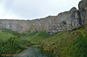
It is a long gorge of 3.5 km. The gorge, between rocky walls of average height 60m, has in its center a species of island called Eyjan. At the end of the tour there is a small lake with green water. It is a short walk but it worth’s it if you have time.
From there we continued the way to Húsavik (2280 hab). We showered at the campsite (paying only for the shower) and took a walk around the village (literally, three streets). This fishing village is the starting point for whale watching. As there was not much to do in the village – and I was very excited – we decided to buy the whale excursion (60 € per person). We compared the price of several companies (they all have it published at the port), the price is similar and the duration also (2h) so we chose the one that best came to us from schedule (we left about 8pm, but since night falls after midnight … no problem). All had a 98% sighting success. It was impressive to me. Highly recommended if you have never done it. We saw several humpback whales.
Do not forget to take pills against dizziness. We took them from Spain … but we forgot them in the car and we ended up suffering. It did not make very good weather, at times it rained, we were quite cold (although they give you an extra coat and hot chocolate) and the movement of the sea does not help.
On the way back we had some warm dinner in the van (soup not to change 😉) and to sleep!
Day 10 (Sunday 31/07):
We started the day shopping in the hypermarket of Húsavik, we washed the car that we could barely see the outside through the glass.
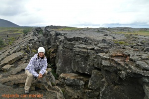
Then we returned to the road 85 + 87 towards the Lake Mýtvatn area. After Reykjahlíd, road 1 borders the lake on the south-east side: in km 2, in front of a group of houses, a barrier gives access to the runway, which has to be carefully traveled. The crack of Grjótagjá and Stóragjá are located 2 km away. They are deep faults of volcanic origin that run parallel to the coast of the lake. They have underground caves with standing water and you can access the interior.

In this area there are many walking routes where you can enjoy the scenery that Iceland offers. From the parking of the two cracks leaves a path that makes possible a long 3 hours excursion to Mount Hverfjall (452 m), with a crater of explosive origin 150m deep approx. From its summit you can see a splendid panorama of the Mýtvatn area. We climbed the volcano, surrounded the crater (not quite necessary) and returned on our steps.

We took the road 1 to the extensive area of geothermal phenomena that occupies the western and eastern slopes of Mount Námafjall (482m). The visit is free and the bounded areas must be respected (clearer, white, light gray and yellow spaces indicate the non-practicable surface layer, with pools of boiling mud). As soon as you leave from here following the Ring Road (in the opposite direction to Reykjahlíd) there is a road on the left. After passing through a geothermal power station, the volcanic and geothermal area of Leirhnjúkur, west of the crater of the Viti volcano, is a few hundred meters away. It is a journey (30 min) between lava fields that are still alive.
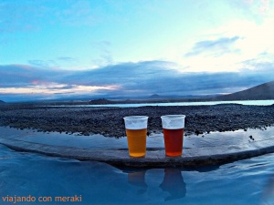
We had no better way to end the day than to take a swim in Jardbödin: the geothermal lagoon of Mytvan, (competing with the blue lagoon). The entrance fee was 4000kr (approx. € 30). The opening hours are from 9am to midnight. Overnight at Reykjahlíd campsite (there are two, one a little cheaper on the outskirts of the village and another in the center right on a grassed lawn by the lake – spectacular place).
Day 11 (Monday 01/08):
In the morning we hired an excursion with our friends David and Bea to Askja volcano. We also bought it before traveling to Iceland on the internet (Mývatn Tours). I should say that the bus takes 4 hours to go and another 4 to return. The time to spend there is around 1 hour, and during the trip there are a couple of half hour stops. Spectacular scenery, but the bus trip is a pain.
You must bring warm clothes, bathing suit, raincoat, mountain boots, double pair of socks in the backpack, water and food.

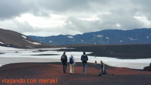
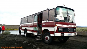
To explore the crater of the Askja volcano, you must take a tour with a special 4 × 4 bus that walks along a path between lava fields and crossing rivers (imagine how smooth the driving).
Once there, you have to walk about 30 minutes (we even cross snow fields, so you’ll need another pair of socks) until you reach the crater of the volcano. The curious thing about this crater is that it has two lakes: one of cold and normal blue water (Öskjuvatn) and another of turquoise and hot water where you can descend (for a slippery and somewhat dangerous path) and take a bath.
Return to Reykjahlíð. Night at the campsite.
Day 12 (Tueday 02/08):
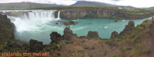
We headed west stopping by to visit Godafoss, the waterfall of the gods. It is 10 meters high, and its amphitheater form increases its spectacularity. You can visit from both sides because there is a bridge.
We continued with destination to the capital of the North, Akureyri (17350hab). This city lies at the bottom of the Eyjafjördhur fjord. It is the largest city in the country after Reykjavik. It has a pedestrian center and here we recommend having lunch / dinner / snack in Kaffi Ilmur (Hafnarstræti 107b). They have a free buffet of vegetables, salads and (when we went) salmon which tasted great. The atmosphere is very quiet and pleasant. Well priced.
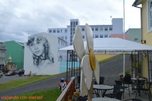
We continued our way towards the Skagafjördur fjord. We crossed Varmahlídh (140 inhabitants), a little village, and continued on the RR (Ring Road), on the way to the Kolugljufur canyon, we did not get very good weather and we were tired so we took some photos and followed Laugarbakki (63 inhabitants). Shortly before the Stadhur farm, where there is a right crossing for those who want to make the route to the Western Fjords, we spent the night in the parking lot of the N1 gas station. We had to spend the night here as it was the best place we found in the area because that day the Arctic winds blew and it was impossible to spend the night in other places.
Before we took a shower in Tangahús Guesthouse (we were about to ask for accommodation for that night), whose owner charged us a symbolic amount to use the showers (but at least we got warm and out of the wind for a while).
Day 13 (Wednesday 03/08):
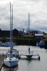
Like every day, we got up early enough to enter the Snaefellness peninsula.
We followed the road until we reached Bordeyri and from here we took the 59 gravel road to Budardalur, to save a good detour. We arrived at Stykkishólmur: it has a very nice port and a very modern church (you will see that the churches in Iceland are like this), we took advantage and we bought in the supermarket of the town.
We returned through the same road to have lunch next to Helgafell, a very curious enclave: it is a sacred mount of 73 meters of height, venerated by the devotees of the god Por. In spite of its small size the mountain was so sacred in the times of the sagas that the old Icelandic retired in it when they were near the death. Today, locals believe that those who climb the mountain will be granted a wish. Of course, you cannot look back at the whole ascent.
We made our way down Highway 54 through lava fields. We left Berserkjahraun and continued our way to Grundarfjörður, a small town surrounded by rounded peaks, located in a spectacular place, about 12 kilometers from Berserkjahraun. We stopped only to take a few photos and we went on to Hellisandur, 7 kilometers from Olafsvik, the only place from where you can see the Snæfellsjökull glacier under which is the Snæfells volcano, the one in which Jules Verne was inspired for his book “Journey to the Center of the Earth” (if the weather is good, because we caught a very cloudy day and we could not see).
We continued the route leaving the crater Saxhöll, as we had read that the visit wasn’t a must.
From here we followed the road to the black beach Djúpalónssandur, 15 minutes through the road 572 between incredible lava fields that lead directly to the sea. In the parking a path of 1.2 km begins.
The views of the volcano from here are amazing. At an altitude of 1446 meters above sea level, the volcano is one of the highest mountains in the peninsula, with the characteristic of having a glacier at its summit, and there are only four kilometers from there to the sea!
We followed the route to Arnastapi, just a few minutes away, where there is the monument to Jules Verne. In this village there is a unique bar where we took a couple of hot chocolates and pancakes to combat the cold and wind we were suffering on this day and we were seated wonderfully.
That day we were quite tired from wind and cold and it was a great discovery to be able to give us a warm bath in the municipal pool which was right next to Kast Guesthouse. After the relaxing bath we were able to camp in the camping area and pay only for parking. The views from here were also very nice.
Day 14 (Thursday 04/08):
We continued towards Borgarnes and we passed through Bejarnarfoss, a small waterfall located 14 kilometers, which was on our way. We continued with our route and after 5 minutes we found the diversion to the Ytri-Tunga farm, a place known in this area because seals are seen from the beach. It is worth taking a walk and having a well-charged battery for your camera.
We arrived in Borgarnes, with a very nice view over the Borgarfjörður fjord. We stopped at the edge of the fjord to eat something. We took the RR north again and taking the turnoff to the right towards highway 50 you will reach the most important hot springs in Europe, Deildartunguhver, where the water (180 l / sec) flows at about 98ºC.
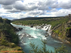
At the northern end of the gorge excavated by the river Hvitá are the great waterfalls of Hraunfossar. The waterfalls emerge from the ground, from the rock. Breathtaking! A little further up is the Barnafoss Waterfall.
We continued towards the capital, note that in the RR road there is a tunnel with toll of almost 6km. To avoid this, we took the 47, which runs all over the fjord. Just at the bottom of the fjord is one of the last whaling lodges in Europe, reason for controversy (Iceland has reopened the whaling since 2006).
We continued and spent the night at the Hafnarfjörður campsite, near the camper’s return office.
Day 15 (Friday 05/08):
Delivery of the rental vehicle and return to Reykjavik by bus. We had booked for the last night a hotel (The Capital-Inn), which turned out to be expensive – like everything in this country – and quite average (much better the apartment of the first day). But having a bath, bed and warmth after so many days in the camper was it was a palace for us.
That afternoon we took a walk to Perlan. It is a building located on a hill, outside of Reykjavik where for decades there have been tanks storing hot water of geothermal origin. It now houses shops, a revolving restaurant and a beautiful gazebo (it’s free to climb).
Afterwards we strolled through the streets of the capital and said goodbye to the trip with a dinner at the Messin restaurant (6b, Lækjargata), where we dined very well. Do not forget to book because in summer it is full. It was around € 80 per couple.
Day 16 (Saturday 06/08):
We returned to the airport in Flybus from the bus station and returned to Spain with Wow Air.
Leave a Reply